
Connie Hodge, Eastern Kentucky University, connie.hodge@eku.edu
Whitney Cox, Corbin Primary School, whitney.cox@corbin.kyschools.us
Sonja Yow, Eastern Kentucky University, Sonja.yow@eku.edu
J. Scott Townsend, Eastern Kentucky University, scott.townsend@eku.edu
Scientists use models to represent phenomena and communicate information about the world. Elementary students can engage in the same process of scientific modeling when provided appropriate structure, context, and practice. When students take part in modeling, they are able to notice patterns and develop and revise representations that become useful models to predict and explain, thus developing their own critical thinking skills and scientific knowledge (Kenyon, Shwarz, & Hug, 2008).
Drs. Connie Hodge, Scott Townsend, and Sonja Yow, professors at Eastern Kentucky University, collaborated with Ms. Whitney Cox at Corbin Primary School to help her second graders learn about map features and utilize their own skills in order to make 2-dimensional and 3-dimensional maps of the school grounds.
The two-week unit began with Ms. Cox recording (on the board) all the things the students knew about maps. Much to Ms. Cox’s surprise, the students already knew a lot about the purposes of maps and map features. What the students didn’t understand, however, was the process of making maps to match a real-life location.
The next step involved the students creating an actual map of the school grounds. The first challenge was to create a regular 2D map. The next day, students took a “mapping walk” in which they walked around the school grounds. Students made written notes in their mapping journals and took pictures and videos of all aspects of the school grounds with iPads.
Students began working, in their cooperative learning groups, on their maps using chart paper and markers. As a result of running into several issues regarding spatial and orientation problems, students used their sheet-paper sized maps on additional walks. The maps improved significantly. The students struggled with the process of matching actual physical property to a map on a sheet of paper, but the instructors allowed them to struggle with it as long as they improved each time.
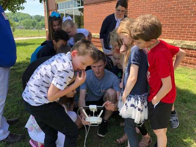
The last aspect involved having the students use plastic trays, homemade Play-Doh, paint, and other materials to create 3D maps that would complement the 2D maps. When students began to struggle with the 3D maps, Mr. Ben Childers, a videographer from the local community, came to the school to show how he used his drone for commercial purposes. Mr. Childers did a complimentary flight with his drone and provided all pictures and videos to the class. The students were able to examine the school grounds from an aerial viewpoint.
After two or three iterations for the 3D mapping, students ended up with final products that included the 2D maps with their 3D versions of the same property. The exercise allowed students to think like scientists and great explorers, by actually mapping something they observed first-hand. The maps were proudly displayed at the entrance to the school so that other students, teachers, and community guests could view them.
Corbin Primary School is one of the schools in the Corbin Independent School System that is part of the Clinical Apprenticeship for the Preparation of Teachers (CAPT) through Eastern Kentucky University.
References
Kenyon, L., Schwarz, C. & Hug, B. (2008). The Benefits of Scientific Modeling. Science and Children, v46 (n2) 40-44.